 geocatalogue.geoportail.lu
Main>Geographical location>Topographical maps>Historical topographical Maps
Type of resources
Available actions
Topics
Keywords
Contact for the resource
Provided by
Groups
Years
Representation types
Update frequencies
status
Scale
-
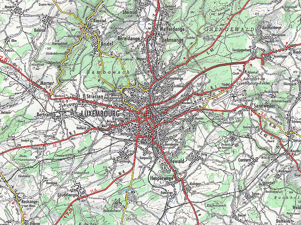
Historic topographic map edited in 1970
-
-
Historic topographic map of Luxembourg for school teaching, 1950 Editeur: Aloyse Linster Auteur: Kümmerly & Frey
-
Historic topographic map edited in 2000
-

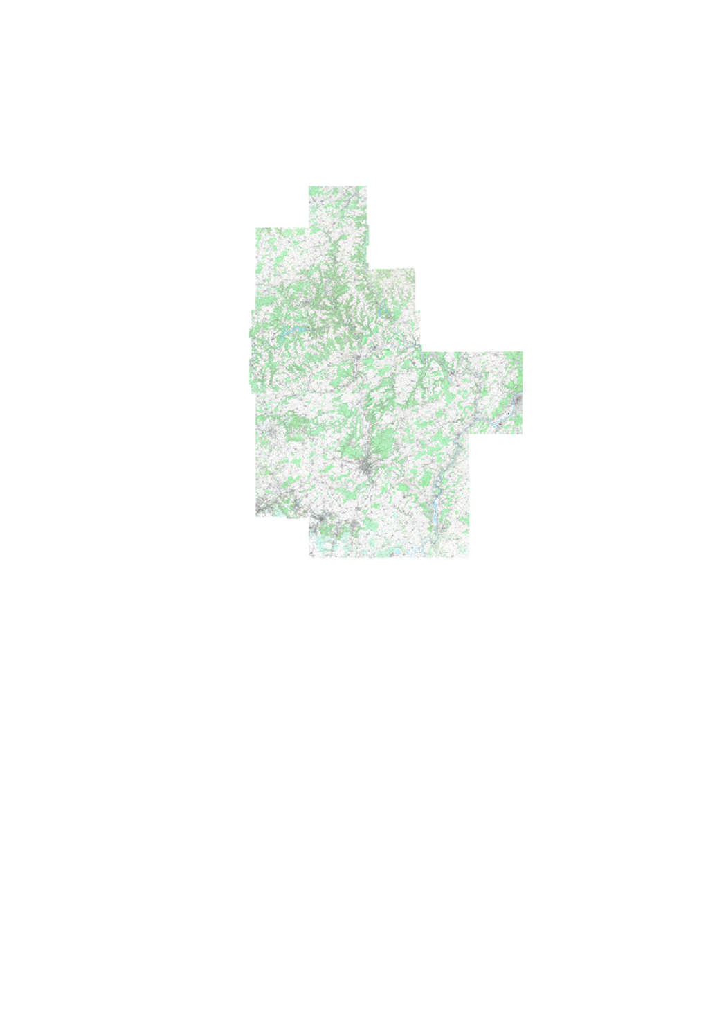
Digital topographic map at scale 1:50.000 issued from the BD-L-TC. Exists as rasterfile (TIFFormat, 2 sheets, North and South) as well as vector- database, including a style-file for ARCGIS. Paper edition with tourist information
-
Historic topographic map edited in 1964 scanned
-

Historic topographic map edited in 1964 scanned in black and white
-
Historic topographic map edited in 1979 scanned in black and white
-
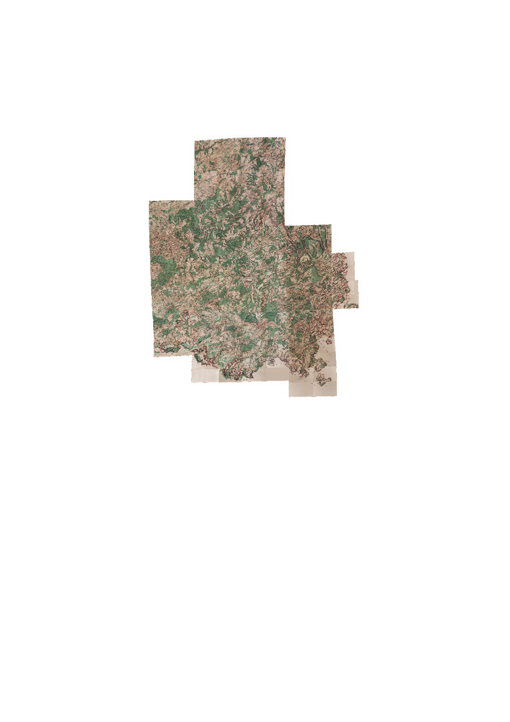
The Ferraris map is a historic map crated between 1770 and 1778 by the count Joseph de Ferraris (17261814), on demand of ther governor Charles de Lorraine. The surveyings concerned the actual belgian and luxembourgish territory, and part of the actual dutch and german territory. Completely drawn by hand, the Ferraris map had a military destination, and showed strategic elements like rivers, bridges etc, as well as relief, ground occupation, habitat, streets and water, parishes and administrative borders of that time. The maps were made on a scale 1:11,520 and formed a collection of 275 hand-colored and maps. The map has no geodetic reference system. Three originals of the maps remain. One is in the Kriegsarchiv in Vienna, one is in the Rijksarchief in The Hague and the third one remains in the Royal Library of Belgium in Brussels. This version can be seen entirely on the website of the IGN Belgique, with the approval of the Royal Library of Belgium, and has been published in a paper version in 2009 (slightly reduced version), in form of an impressive book of 51 cm x 40 cm weighing 11,5 kg. For the publication in the geoportail, the different mapsheets have been fusioned and georeferenced. This publication at Luxembourg's national geoportal has possible thanks to the kind authorization by IGN Belgique : 2010, All rights reserved Royal Library of Belgium, belgica.kbr.be Digital or printend maps can be ordered at sales@ign.be For legal reasons, it is not allowed to print the contents of this layer with the geoportal's printing functions in formats above A3 (screencopy size).
-
Historic topographic map edited in 1989